
RADAR APPLICATIONS
IN NORTHERN ENGLAND
Radar Applications in Northern England (RAIN-E) is a collaborative research agreement between the National Centre for Atmospheric Science and the Environment Agency to deploy a mobile weather radar in Cumbria for twelve months.

NORTH-WEST CUMBRIA
The joint Met Office & Environment Agency weather radar network provides rainfall detection for most of the country, but Cumbria is one of the few spots in the UK that is not well observed. With recent flooding episodes having a large impact in Cumbria, this project is an opportunity to use a high-resolution portable X-band radar to make improved observations in this region and further assess the potential benefits from a long-term permanent installation.
Rainfall Observation
Improve rainfall observations in Cumbria until Autumn 2019.
Flood Forecasting
The observations will be used to investigate potential improvements to flood forecasting in Cumbria.
Data Integration
Investigate the Integration of new radar data into the Met Office and Environment Agency network data products.
Long-term Solutions
Provide evidence to support a long-term rainfall detection solution for flood forecasting and warning services.
A RESEARCH COLLABORATION
Radar Applications in Northern England will be delivered by a collaboration between the National Centre for Atmospheric Science and the Environment Agency. This work will supplement the UK rainfall detection strategy, which is being carried out by the Environment Agency alongside the Met Office.
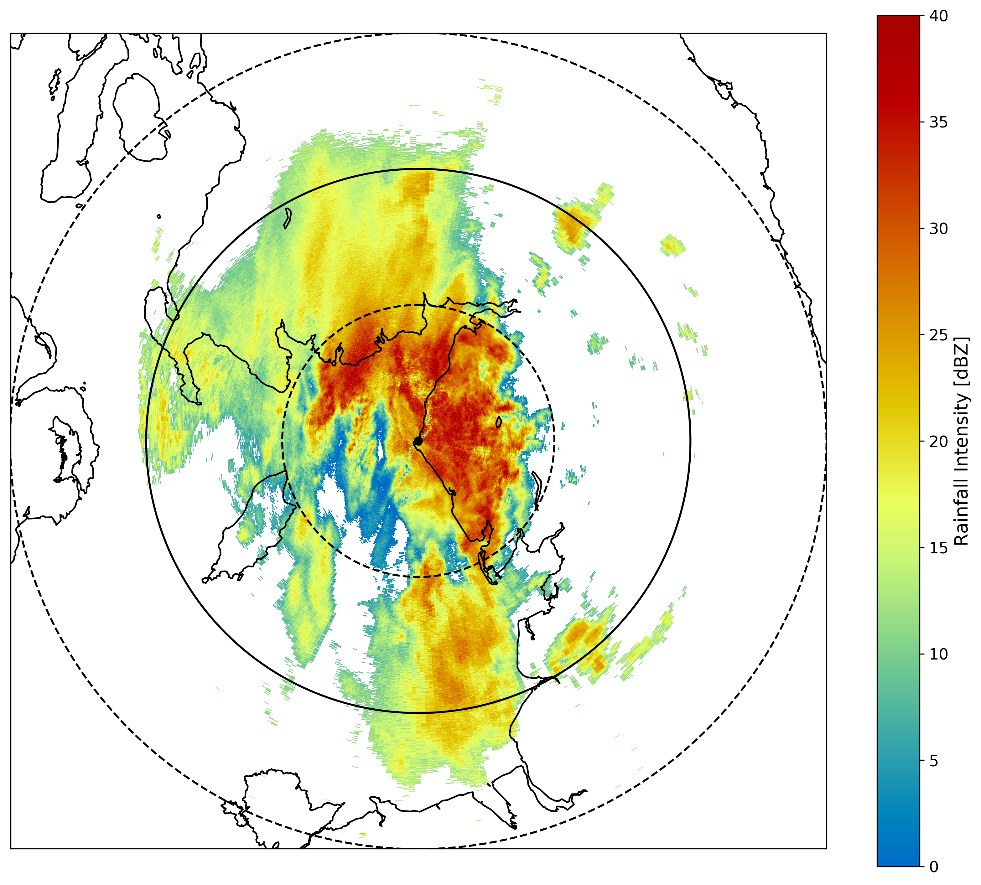
Data collected by X-band radar at 1:33am on 1st November 2018